This is a story about my solo backpacking trip to the Grand Canyon in late October, 2007. It was my 5th backpacking trip in the canyon, but I've taken other tourist-type trips there as well. The story begins with the long day I had travelling from my home in the Upper Peninsula of Michigan to the South Rim of the Grand Canyon.
Alice and I got up at 4:30 the morning October 23 and were at the airport before 6:00. After the usual hassles getting through the airport system, we had some time to sit and talk in the airport lobby. Then came the time to go through all the X-rays and wait for boarding in the staging area. I sat next to a guy that must have been a mucky-muck at Terex in Baraga. He was talking to some friends about all his travels, and it just seemed like a lot of bravado to me. It may have been the fact that I had recently read Howard Zinn's "The People's History," or it may have been the shabby treatment that my neighbor got from the higher-ups at Terex, but I didn't like that guy. It was soon time to board, so I gave a wave to Alice and boarded the plane. Luckily I didn't have to sit next to Mr. Mucky-muck.
I think this was the first time I've ever flown out of Hancock on a jet. It was nice. Just about 45 minutes in the air and we landed at Minneapolis/St. Paul airport. I had no seatmate this leg, so I could stretch out.
I had over two hours wait at MSP for the ride to Las Vegas. Once I found my gate, I walked several circles around the terminal. By the time I finished my last lap, there were no seats left that I cared to sit in, so I stood by the window and watched the planes land, and the crews do their fueling and other chores.
When the time came to board the plane, they took the first class folks, and then delayed a long time. It turned out their boarding computer wasn't working, and they delayed while they tried to fix it. I eventually got on the plane and got comfortable with my book, sandwich (from home) and granola. The people sitting next to me were nice. I slept twice, but not very well. My neck bothers me when I sleep sitting up. It seems that when I relax my neck it compresses. Steve recently showed me an inflatable neck pillow he had bought, and I think I'll make the investment next time I see one.
As we got close to Las Vegas, I started to recognize features on the ground. I really get a kick out of that. I could easily see the bathtub ring around Lake Mead for example.
Once we were on the ground, I followed the signs to the baggage claim, retrieved my stuff, and went outside to look for an Alamo rental car bus. There was NO Alamo bus. The whole system had changed since I did this a year ago. It's now a lot smarter, in my opinion. There is only one bus line for all the rental companies. They take you to one central place where each dealer has a counter. As I walked over to the Alamo counter, I saw a free kiosk so I stepped up to it. I've never rented a car by kiosk before, but I got through it quickly with no real troubles. I have rented enough cars to know what I'm going to answer anyway, so I just followed the prompts, and got a form explaining where to go to pick up the car. I followed the signs to the parking deck, and easily found the Alamo section. The guy in charge up there looked over my form, and told me I could have my pick of the cars in the last row. I grabbed the first one, walked around it twice to make sure it had no dings, loaded my gear, and drove toward the exit. The checkout went flawlessly, and I was on my way.
Since this was a roofed parking deck, I was unable to get a signal on my GPS. When I hit the road, I really had very little idea which way to turn. I pulled into a convenience store parking lot and sat while the GPS found enough satellites, and then told it to take me to Laughlin, NV. What a comfort it is when the little screen comes alive and tells you to turn onto the next street. Even though I knew almost nothing about where I was, the screen said with some assurance where I should turn, so I felt like I was on my way. To celebrate, and to thank the convenience store for providing me some space and time to get my GPS going, I went inside and bought a big can of Arizona Iced Tea.
The GPS got me safely through the major intersections, and before I knew it, I was at Railroad Pass. From there it was easy to follow the signs to Laughlin. Once I was across the Colorado River in downtown Laughlin, I instructed the GPS to take me to the Grand Canyon. It immediately freaked out and started insisting I make a U turn. It seems it did not know about highway 64, and wanted me to backtrack and travel to Needles, CA to pickup I40! Bogus! I just shut it off and drove. The hills in that part of the country sure did make that poor little car work, but it did its best to maintain whatever speed I set on the cruise control.
I drove for an hour or so and finally stopped for gas at an out of the way exit at Seligman. I was busy gassing up the car and putting gas in the fuel bottles for my camp stove (a tricky procedure since the bottles are small and the pumps don't know how to dispense gas slowly.) While I was goofing with all that I heard a voice say, "Ted?" I looked up and recognized Jeremy Emmi, the man in charge of the Michigan Nature Association and a good friend. He was on vacation and just happened to stop at the same gas station at the same time I did. What are the chances? We had a nice chat and then he headed west, and I east.
I didn't stop for lunch, so made good time, and was at the Grand Canyon Back Country Office a little after 5:00 PM. I had called them the day before to see if they could make a slight change in my hiking itinerary, which they did. We agreed they would put my revised permit in an envelope with my name on it, and put it in the bushes outside the office. It was right where they said it would be, so I took it back to the car, stuck it inside my backpack, and then walked over to the Maswit Lodge cafeteria and had veggie chili in a bread bowl. Mmmm.
I think I was kind of tense from the big day; all the traffic and hassles and not sleeping too well the night before. In fact, I remember wondering when I was in the depths of the crazy traffic whether it was worth all this. I put a lot of money and energy into hauling my carcass out west so I can walk 45 miles. When you figure the cost per mile, it really adds up.
After supper I checked in to the Bright Angel Lodge, called Alice to tell her I had made it safely, and started getting my gear organized. There is a dance to be done to switch from the rim gear (blue jeans, tennis shoes, wallet, etc) to backpacking gear. Everything has to go into one pile or the other. The rim stuff has to go into the trunk of the car, and all the backpacking stuff stored in the room. A mistake at this step could be crucial. It would be easy, for example, to lock the car keys in the trunk in my jeans pocket. I've made serious blunders at this stage before, so I ratcheted up the stress level and checked everything over and over.
I hauled the rim pile of stuff out to the car, and by the time I made it back to the room, I was pretty sure I had done alright. I managed to read for a bit, and finally turned off the light around 8:00 PM, which was 11:00 eastern time. It had been a big day, and I was tired.
I woke up many times that night. The noisy neighbors were foiled with foam earplugss. At about 2:00 AM I got up and partially dressed so I could go down the hall to the bathroom (my room had only a sink.) I had set the alarm for 5:30, but wound up getting up earlier and turned the alarm off.
Since I was pretty much packed, all I had to do was clean up, fill my water bottles, put a few things in my pack and walk out the door. The trailhead for the Grandview trail is a half-hour drive from Grand Canyon Village. In discussing strategies with the park rangers, I decided to leave my rental car near the Bright Angel Trailhead, where I planned to hike out in 6 days, rather than drive to the Grandview and then have to come back for it at the end of the hike. This involved taking a cab to the Grandview trailhead. I had tried to make a reservation with the cab company, and was told they did not accept reservations. They said just give them a call when I was ready. I was at the front desk at about 5:45, checked out and asked the desk clerk if she'd call a cab for me. When she got off the phone she told me they asked us to call back after 6:00. This gave me a chance to use the pay phone to call Alice and let her know I was packed and ready to go. It was just before 9:00 Eastern Time when I called her office, just before she had to leave for class.
The clerk called back at 6:00 and told me they would pick me up in 35-40 minutes! That was hard to swallow. I was *so* ready to go. Mornings are the best time to hike, especially when it is light enough to see but still pre-sunrise. It is cool then and you usually have the trails to yourself. So all I could do was sit in the lobby.
I wrote several of the first pages of this story while waiting, and then sat out on the porch of the lodge and waited. There were lots of people around by this time. One group was of 4 young women that appeared to be preparing to leave on a backpacking trip, although they had daypack sized packs. Perhaps they were going to run down and up? They were sipping coffee and talking excitedly among themselves. One ask the other if she wanted some breakfast, and she answered she wasn't hungry... "maybe I'm nervous," she said. I tried to catch an eye to strike up a conversation, but they didn't seem interested.
The cab came; a white Xantera Dodge Caravan. We threw the gear in the back and I rode up front with the driver, a Hispanic woman I got to know a bit during the half hour drive to the Grandview trailhead. She told me about growing up in a two room adobe house with wood heat. She said the family hunted and gardened, and that was her background. I told her I have a similar background, and that I'm still doing it today.
When we arrived, she said the fare was $25. I gave her 2 $20s, and she said she had no change! Fortunately, there were some people watching the sunrise at the overlook, and I announced I was looking for change for a $20. The best deal I got was from a guy that had $18. That allowed me to pay the driver and give her a $5 tip. She told me what she said she told every backpacker she dropped off, "vaya con dios," which she said means go with God. I thanked her and asked her to take a picture of me at the trailhead before she left.
I had some pent-up energy when I took my first steps down the trail. Due to the vagaries of transportation, I had gotten a much later start than I had hoped. The ride in the taxi had kept me in the rim world somewhat more than I had hoped for. Finally the first steps down the trail happened. Come what may, the next 6 days and 5 nights of shelter, bedding, food, and other essentials were inside my backpack. I try to fight back the, "did I remember the..." feelings. It's too late for that now. The time now is for enjoying each step being made into this other world.
Not far down the trail there were 3 guys perched on a ledge above the trail with lots of tripods and camera gear. I asked them if they were the paparazzi. They laughed. One of them asked me to stop and pose for a picture, which I did. Perhaps I'll be Mr. October in the National Parks Quarterly :-)
I soon got into the swing of the hike. Carrying about 4 liters of water and a full canister of food made my pack heavy. I also probably had a pound or two of extra fat around my middle that I wouldn't be carrying out either,
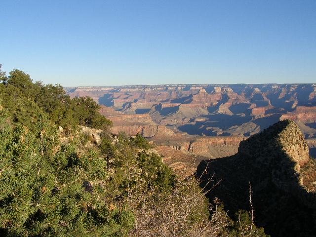
The Grandview Trail got its name honestly. I made up my mind to do some photography this trip, and took several pictures on the way down. I'd think to myself, "hey that would be a nice picture," take it, turn 90 degrees; see another one, take that one, etc.
After a few hours of hiking I began to see evidence of the mining that had taken place on Horseshoe Mesa. I have to admit that while I had looked at the map prior to the start of the hike, I didn't have a good mental image of where I was going. A good navigator will stare at a topo map until the 3 dimensions are obvious. I sort of skipped that step. So I hiked past some mine ruins and saw a nicely bordered path to my right and headed down it. There was no apparent sign.
I hiked around the corner and down a very neat valley. There were more mine ruins, and I crossed a tailings plume for the Last Chance Mine. I was enjoying the hike while going down down down, and soon encountered a much worn sign that said, "Page Spring." I did remember from my map that Page Spring was a 45 minute walk from Horseshoe Mesa, and was the closest water. There was no visible water near the sign, however. I began to get that sinking feeling in my stomach that any traveler understands; when it becomes clear that a costly navigational error has been made. I hiked to the bottom of the draw, took off my backpack, got my powerbar and map out, and quickly decided I had hauled my backpack a long needless way down several contours on the map. There was still no sign of Page Spring.
About ľ of the way through the powerbar, I got up and hiked a little further down the trail, stood there quietly, and heard a sound that didn't belong. I walked a little further and saw a color that also didn't belong... GREEN... Page Spring.
It was then that I decided what I was going to do. I went back to my pack and got the filter and empty water bottles and returned to the spring where I topped off at 6 liters. I remember looking up at the mesa top, putting on my heavier pack, and taking that first step. It was a tough haul, but I made it with several rest stops.
Once back on top, I hiked to the ruins of the old stone mining house. There was some welcome shade inside, so I went in, took off my pack, and got out the park service literature about hiking and camping on Horseshoe Mesa. I learned where the campsites were, so hoisted up my pack and looked them over. I was the first one at this campsite, and therefore had my pick of the three that were up there. I chose the one closest to the mesa edge, and got my gear organized. I was sitting on a rock in my campsite and enjoying the view when I heard voices approaching.
Two guys about my age walked up. They were looking at the campsites too, and when they saw me they walked over and struck up a conversation. They were brothers-in-law, and both named Dave. Their original plan was to hike down the Tanner trail and across the Escalante, but the park service had closed the Tanner due to a rockslide. So they had gone to the backcountry office and worked out a new itinerary that had them going down the Grandview instead and going west to the South Kaibab, and then out... 5 days and 4 nights. I really enjoyed talking with Dave and Dave, and suggested that since they were heading my way we might hike together. They thought that sounded ok until I told them I planned to get up at 5:00 am. They said if we're up, we'll hike together, but if we're not moving around, please don't wake us. I got the message.
This campsite had a nice rock table and a kind of stool to sit on while organizing my stuff for supper. Nights one and two are usually burritos because the tortillas are the most perishable. I brought enough for 2 each for 2 nights. I fired up my new Primus stove and got the water going, then added the refried beans and rice, and turned the stove down to low. This was the first time I'd used the Primus on a hiking trip, so I was interested to see how it would perform. It is a loud stove, and it burns hot and fast. Interestingly, the fact that it is so loud is a plus when it comes time to simmer your food. My strategy is to turn the gas down as low as possible and make the stove sputter, which is plenty of heat to cook with. It gamely sputtered and the pot simmered away. When the sputters got too far apart, I cranked the valve up just a bit, and away it went again. By the time that first supper was cooked, I knew I had made a serious upgrade by trading my old MSR for the Primus.
I perfected cleanup that first night. Since water was going to be so dear the first 3 nights of this hike, I used heated filtered water (no soap) to rinse the dishes, and then drank the wash water. I then repeated the process. I learned how to cook supper and clean up with less than a liter of water.
I hiked to the northern edge of the mesa to look for the trailhead that descends to the Tonto. I would need that trail in the morning when I started my hike to the west. Dave and Dave told me the ranger had told them that it is easy to miss that trail, so I wanted to scope it out. I figured it would benefit me in the dim morning light. My body was still on Eastern Time, and the day was already starting to get dusky at 6:00. I walked over to the cliff near my campsite to sit a spell and just let the canyon magic seep into my soul.
When I got back it was pretty dark. Dave and Dave had just returned from getting water at Page Spring. They complimented me on hiking all the way down there and up with my full backpack. I climbed into my sleeping bag and listened to them working on supper. Those two laughed and joked nonstop, and sure did seem to enjoy each other's company. I finally put my ear plugs in and fell asleep.
I was up early and ready to do my big hike of this trip. My permit allowed me to camp essentially anywhere within a large area for the next two nights. My plan was to make this day my long hiking day. If I could chew up a bunch of miles today, I could take it a little easier for the next two days. The minimum I hoped for the first night was Grapevine Creek (good water,) but Boulder Creek was a few more hours down the Tonto and therefore even better. Before I left home, a ranger had told me on the phone there was no water at Boulder Creek, however, which made me skeptical of camping there.
I was packed up and hiking a little after 6:00. There was not even a faint rustle from the Dave camp, so I didn't wait around. I retraced the path I had taken on my exploratory hike the night before to the north exit of Horseshoe Mesa, found the trailhead, and started down the many switchbacks that would take me down to the Tonto East trail. I got most of the way to the bottom and found a nice place to prop up my pack with my hiking staff, sat down, and ate my morning granola as the sun began to fill the canyon. I thought to myself, "If it gets any better than this, I'd like to know about it." And of course I had the whole thing to myself.
Once back on the trail, I soon found the Tonto, and headed west toward the Kaibab trail. The Tonto swung around south soon after I encountered it, and took me to the Cottonwood Creek campsite. I arrived there at a crossroads sign about 9:00, or roughly 3 hours of hiking. The sign said, "Grandview Trailhead 4.5 miles, South Kaibab TH 23 miles." So the 3 hour hike I had done had only gotten me about a mile toward the South Kaibab trail. I dropped my pack, grabbed my water filter and bottles, and hiked up the creek bed. I saw 3 guys that were just getting their day going, asked them where the water was, and they told me to just keep hiking up the creek bed and I'd find it. One of the three seemed pretty hostile for some reason, but I just brushed it off and hiked up to the water.
I filled up, and continued on down the trail. It was a beautiful morning, and I was plodding along at my usual pace. I met a lone female hiker about my age, both of which were unusual (her gender and her age) for that stretch of trail. She seemed very energetic and we talked for a few minutes before parting company. Shortly after speaking with her 3 or 4 guys hove into view. We chatted for a good 15 minutes or so, and exchanged information that benefited both of us. They told me there was good water at Boulder Creek, which made me determined to extend my hike that far. And I told them that the Tanner Trail was closed due to a rockslide. These guys' permit had them hiking out the Tanner, and since they had been on the trail for 3 or 4 days already, hadn't heard about the Tanner being closed. We discussed various strategies for them before we parted company.
Whenever I hike the Tonto, I wonder when I'll get my first glimpse of the Colorado River. The Tonto is quite shy about sharing that view, because the gorge leading down to the river is quite steep. This trip I got my first view of the river shortly after I spoke with the hikers.
A bit further down the trail, I saw a half dozen white rumps moving up the hillside in front of me. Thinking they were mule deer, which are as tame as dogs in the canyon, I said out loud, "Hello mulies." On closer examination I determined they were not mule deer, but a group of female bighorn sheep. By the time I got the camera out they were gone. However, bringing up the rear was a big male and two much smaller sheep. This time, I was lucky enough to be ready for them with the camera.
Hiking into the Grapevine Creek canyon was a long haul. At one wash crossing I got somewhat mixed up, and lost the trail completely. I switched the GPS on and determined I needed to hike up in elevation from where I was in order to find the trail. Normally when I lose the trail, I backtrack to the last known good sighting of the trail, and then proceed carefully from there. This time I put my faith in the GPS, and it led me up a lonely hillside through some pretty thick brush and loose rock. Anyone that complains about the condition of the Tonto trail should spend some time bushwhacking. The Tonto seems like a super highway compared to what is all around it. I probably stumbled around for half an hour up there. The GPS indicated I was on the trail, and in fact crisscrossing it, yet no trail presented itself. I looked around and tried to think where I would put the trail if I were laying it out. It was mostly obvious where it needed to go, because the ultimate goal was clear. It is just that the possibilities were large, and spotting such a thin ribbon of trail had a lot to do with being at the correct vantage point. I finally sat down and looked around a little, and there about 30' below me was the trail. I hiked on an intercept course, and was soon cruising down the Tonto again.
I arrived at Grapevine Creek pretty tired but happy that section of trail was behind me. I got out my lunch stuff and started preparations to eat. The campsite is a real nice place with a shade tree and theoretically in close proximity to water. During lunch two of the guys I had seen at Cottonwood hiked up. We talked a little and I told them I would probably be hiking on to Boulder, so they could have this campsite. They then took off upstream to scout other camping possibilities. I sat and ate my lunch for a while, and then the third guy came hiking up the trail. I greeted him in my usual friendly way, and he ignored me. Ahh, this is the guy that was hostile at Cottonwood. Thinking perhaps he just didn't hear me, I told him, "Your friends hiked up that way," while I pointed with my arm. He said to me, "Yes, I *saw* them hiking up *that* way." Wow, this guy has problems, I said to myself. Maybe he is a macho guy that was being out hiked by his pals or something. Whatever it was, he had a serious dislike for me. Whatever, I thought.
After finishing my lunch, I grabbed a couple of water bottles and the filter and went searching for water. I hiked up the wrong fork of the creek for quite a while, and then back down and across a small hill separating the two forks. I happened across a guy that was solo camping in a very pretty spot, and asked him about water. He pointed me in the right direction, and I quickly got my water chores done. While hiking back to my pack when I encountered Mr. Hostile and one of his friends. They told me that they observed a raven open the zipper of my backpack and going after a Ziploc bag inside. Mr. Hostile was the one that saw the event, and he chased the bird away and kept a watch on my gear while I was filtering water. I thanked him profusely and thanked my good sense for not telling him off earlier. Bridges are easy to burn and hard to mend. I packed up and hiked off a wiser and happier camper.
Just a few minutes down the trail toward Boulder Creek I came to a wash crossing that had some confusing cairns on it. They appeared to show the trail following the wash up the hill. I followed them without thinking about it too much, but saw no further cairns or signs of the trail. I backtracked and turned on the GPS again. Yes the cairns clearly said to go the way I went. I tried again with the same lack of success. Looking carefully at the GPS it seemed the trail should be crossing the wash at this point, not following it. Back at the confusing cairns once more I discovered a small cairn across the wash and the trail clearly beyond that. Another half hour lost due to poor trail finding.
I continued on and stopped only once for a powerbar break. I was adjusting and readjusting my pack straps as the load was really settling in on my back. I was getting tired. The sun was getting lower and finally slipped behind the canyon wall, making for cooler hiking, but also meant I had better find Boulder Creek soon. It was dusky when I turned a corner in the trail and heard voices. Two guys were there ahead of me and had claimed the one good obvious campsite. I told them I'd been hiking for 12 hours and wondered if they had seen another campsite. They suggested I use the wide spot where the Tonto crossed the creek, and that is what I decided to do. I didn't even put my tent up that night. I lay my bivy down on the gravel, put my sleeping pad inside the bivy, and my sleeping bag on top of all that. On the off chance it would happen to rain, I could escape the rain by slipping inside the bivy.
My new friends were just leaving to get some water, so I tagged along and filtered enough water for the next day. When we made it back to the campsites, it was pretty dark. I put my headlamp on and got the supper fixings out. Burritos again, but I was extra hungry that night after all the hiking, so I fattened up the beans and rice filling with a pouch of tuna I had brought along for emergencies. It may not sound too appetizing, but it slipped down my throat and into my happy stomach without any fuss. I then cleaned up, rearranged things in my makeshift under-the-stars campsite, and fell asleep. I remember wakening a few times that night when a fly landed on my face, but other than that slept surprising well on my cement bed.
I was awake around 5:00 am. The sun wasn't up yet, but the full moon was giving lots of light to the canyon. With no tent to put away, packing up very quickly, and I was off just as daylight was starting to filter down the canyon walls. As long as the trail is obvious, this is my favorite time to hike. And I almost always have that time of day to myself to boot. I made a brief breakfast stop at a nice place in the trail.
Today's goal was to cross Cremation Creek and get as close to the South Kaibab trail as legally possible. The Park Service must have had problems with people camping too close to the South Kaibab trail, so they erected two chest-high cairns at the western-most place where people with the BJ9 area permits could camp. Getting to Cremation involved hiking through Lonetree Creek where the rangers said there was good water. I decided to stop at Lonetree and filter 6 liters, Which I hoped would be enough to get me to Phantom Ranch. I found the dry creek bed with no trouble, dropped my pack, and went in search of water. I hiked quite a while downstream and was getting a bit discouraged. The walk was a long one, and every turn just showed more of the same dry creek bed. What kept me going were signs of many other hikers going the same direction. That plus the rangers had said I would need to hike downstream for water at Lonetree. After more than half an hour of hiking I came to a cottonwood that could have been the "lone tree," and a few more feet downstream I discovered the first trace of water. It was just a tiny puddle with a slow trickle flowing into it, but it was deep enough to get the fill tube of my filter under water. Filtering water is a great way to soak up the sights and sounds of an area. With all my bottles full and loaded into my my daypack, I hiked back up the familiar creek bed, reassembled my gear, and headed on down the Tonto.
I decided to cross all 3 washes of Cremation Creek and take my chances that I would find someplace to camp on the other side and before the cairns. The first two washes were very straight forward. As is usually the case, the trail headed toward the red wall of the canyon, and crossed the wash at a place that involved little elevation loss or gain. By the time I got to the third and final wash, my luck had changed, however. I was hiking along the side of a fairly steep hill when the trail abruptly headed straight down the steep hill.
By now I'd leaned that when something doesn't feel just right about the trail, it is best to stop and figure out what is going on. There was a place near the steep decline of the trail that had just enough room for my pack and myself. There was a rock I could lean back on, and there was some shade from the butte just behind me. I took a powerbar break and looked things over down the hill. At first I couldn't see anything down there to suggest a trail. I looked up canyon and saw that the trail would have to go down at this point, because there was a sheer wall just beyond where I was sitting. I looked closer as I munched my powerbar and saw what looked like a campsite down the hill, and the unmistakable signs of a trail. This was the place. This trail demanded attention due to its steepness and all the loose rock. As I sat there I noticed that whenever I moved the rocks would grind together and make a sound not unlike two kiln dried bricks being rubbed together. This place is dry, I thought. No wonder they called it Cremation Creek.
After the break, I carefully hoisted my pack and walked back to the trail. I say carefully because a false move could have started a rockslide and a painful ride down the hillside on my butt. I carefully picked my way down the hill with my staff, free hand and both feet. The dry rocks talked to me as I went down the hill.
Once at the bottom, I had a good look at the most likely campsite. There was no sort of tree or bush to give any shade. This site would be ok in a pinch, but I was not attracted to it. Besides, the day was still relatively young, so I hiked on.
About another half mile down the trail, I came upon a site that I thought must be a mirage. On the left side a massive boulder had a section carved out of it, and under that was a sandstone table with 3 sandstone chairs arranged around it. It was pleasantly cool in there, and in case of rain, perfectly dry. Next to the roofed kitchen area was another sandstone chair that had a backrest against the boulder. Just downhill from this complex was a clear level area big enough for 3 or 4 tents. It was the perfect campsite. And it was empty. In fact, I hadn't seen a soul all day. I quickly dropped my pack and looked things over. There was still a couple of good hours of hiking time left in the day, but I didn't know how close I was to the boundary cairns. After thinking it over for about 30 seconds, I decided to camp here.
This was one of the nicest campsites I have ever used in the Canyon. Bright Angel and Indian Gardens both provide picnic tables and cooking areas, but this one had probably evolved from years of hikers making small improvements until this beautiful site presented itself. I spent some time putting up the tent and getting the kitchen squared away for an eventual meal, and also just sat and rested my back on the cool rock wall and looked out toward the Colorado River, which was hidden somewhere below. If someone were to hike up and need a place to camp, of course I would have let them stay, but I sincerely hoped I would have it to myself.
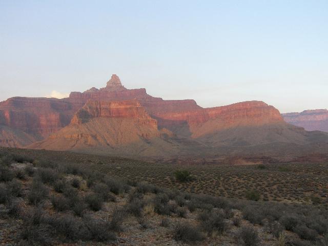
As the day lengthened, I cooked and ate supper, cleaned up and was pleased with the amount of water left in my stores. I sat and watched the sunlight die from the canyon and saw the glow of the full moon in the east. Then I heard voices. "Shoot." I could see headlamps and watched them progress down the trail. I began to resign myself to company that night until I realized where the hikers were. They were heading my way alright, but they still had the dangerous climb down the steep Cremation Creek hillside, up the other side, and the half mile or so until they reached my spot. These guys were quite vocal, and I figured it could be my friends Dave and Dave, who said they would be coming this way. They must have discovered the steep direction the trail took and wisely backtracked and set up their camp on a flat spot a quarter mile before the trail descended. It was with growing relief that I watched their headlamps bob around as they set up their campsite across the wash from me. The sunset and moonrise were redder than those I'd observed so far in the hike. I was in my sleeping bag by about 8:00 and slept soundly until about 5:30.
I awoke and noticed that assembling my gear was getting easier. The first day or so it takes a while to develop the routine of packing up and hitting the trail. By this time I didn't even have to think too much about it. As I was packing up a group of three hikers heading east came through the camp. I complimented them on their early start. They did not want to stop and talk and I did not press them to. I was hiking about a half hour later just as the moon was giving up and the sun was starting to lighten up the eastern sky. The trail was pretty obvious until it took off up a steep hillside. I missed a cairn again and assumed the trail wound around the hill to the right. Others must have made similar mistakes because a trail of sorts was there. As I continued along the trail petered out to nothing. I finally turned on the GPS and looked things over. It was somewhat confusing but the arrow showing my position clearly diverged from the trail. I started hiking in the direction I thought the trail should be, and watched the direction of the arrow change to indicate whether I was moving in the right direction. After several hit and misses, I was back onto the real trail at about the place where I had gone wrong. I looked all around and looked at the GPS and finally determined the trail needed to go up. I looked up the hillside and saw cairns sprouting like mushrooms. I secretly thanked all the trail angels that had erected those cairns and continued on my way.
A short while later the park service cairns came into view. A half hour or so beyond that and I noticed a structure with a solar collector on it, and then a bathroom was evident. I knew then I was at the Tipoff as this intersection between the Tonto and the South Kaibab was known. With no real reason to stop, I hiked until the Kaibab was under my feet. What a difference. Just a mile back I had lost the Tonto in a maze of boulders on a hillside. Here was a groomed trail wide enough for 3 people to walk side-by-side. The trail showed unmistakable signs of recent improvements. I think I was a little slack jawed as I headed down the trail toward the Bright Angel campground. I happened to know there were about 3 miles yet to hike, and on this trail the miles would fly by.
I began to encounter hikers too. Most were hiking up the Kaibab on their way out of the canyon. A few were on their way down. All seemed to have a few things in common. They were much cleaner than I was. One guy was chewing gum! They were also much less friendly than those I had met earlier in the hike. And there were a lot more of them. And I saw my first mules this trip.
I thought about the canyon and the different reasons people have for hiking there. My reasons are complicated, but the main reason is to escape the artificial world I normally inhabit and absorb the sights, smells, physical exertions, and simplicity the canyon offers. The trickle of life giving water is one small example of the basics I strive for down there. While I know I still depend entirely on the real world while I'm down in the canyon, I feel more like a skin diver using a snorkel when I'm hiking. I'm still getting my air from the real world, but I get a very real sense of the other world at the same time. While not casting aspersions at the type of hiker I encountered on the South Kaibab, I conjectured that their hike was more of a physical challenge to get down and up the trail, and then say they did it. There are many reasons for backpacking in this magnificent place, and I say that pretty much whatever brings people down here and safely back out is ok with me.
I stopped and took some pictures of the Colorado and the the black bridge. The hike to the bottom went smoothly and quickly. I began to wonder what I would find at the first Bright Angel Campground bridge.
The last time I camped at Bright Angel it was with my brother Gerry on our 2005 Grand Canyon hike. An important segment of the trail that led out of the south end of the campground was closed with a barrier and a sign that warned that a rockfall had made the trail unsafe. The fact that section of the trail was closed meant that people hiking in and out of the campground from the south had to hike a long way around to the other bridge. It struck me at the time to be inconvenient and foolish. In fact, when I got home from the 2005 hike, I wrote to the superintendent of the park and expressed as much. I received a nice reply from the assistant superintendent thanking me for my comment and promising to look into reopening the trail. Walking across the black bridge and down the trail to the campground, I couldn't help but wonder if the park service had reopened the trail.
I hiked across the south bridge to see for myself, and lo and behold saw lots of hikers going to and fro down the previously closed trail! I'm sure the people I passed on my way to the campground wondered why I was grinning like an idiot, but they didn't ask and I didn't volunteer.
Campsite 28 was empty so I grabbed it and got my tent up and gear organized. I really wanted to do two things right away: wash my clothes, and wash my hair. Bright Angel Campground is different from any I'd used so far this trip. Every site is always claimed, so before leaving this plum site, I erected my tent and hung my permit on it. I walked the short distance to the bathroom and over to the outside sink I had used in the past to bathe and wash clothes. There was a sign posted that said "Dish washing only. No clothes washing and no bathing." Argh!
I walked back to my campsite pretty discouraged and then got to thinking. The Bright Angel Creek was noisily flowing just a few feet from my campsite. Some enterprising folks had ringed this campsite with various sized rocks, so I began to rearrange the rocks until I had a ring of them about 3' in diameter. I then grabbed my pack cover and took it down to the creek. I put it under water, gathered up the corners, and lifted up a bag full of water. I carried this heavy drippy bag back to my campsite and draped it over my rock ring. The dam held and made a nice basin for clothes washing. I put on my rain pants, put everything else in the basin with some biodegradable camp soap and agitated my clothes until the water turned brown. I then emptied that water on a nearby cottonwood tree, and got a fresh basin full of water, and rinsed all the clothes. The water then changed to a slightly lighter shade of brown. Once I'd wrung everything as dry as possible, I hung my laundry out on some parachute cord. I got one more load of water and washed my hair. And yes, the water turned brown one more time :-)
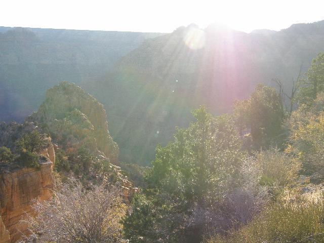
I was happy to be able to comply with the park service rules, wash my laundry and my hair, and irrigate some thirsty plants in the process. I then made the hike to the back of the Phantom Ranch Canteen where the pay phone is located, and called family to tell them all was well. It was around this time I noticed the first of many signs posted around the ranch that explained the red sunset from the night before. There were controlled burns in progress on the North Rim, and the signs warned that smoke would likely filter into the canyon. I got several neat pictures of this smoke and its effects over the course of the next two days.
I then hiked to Bright Angel Canyon and located a place to scoot off the trail and down to the edge of the creek for a bit of privacy. I sat there for some time before doing my traditional singing of Bend in the River. This is a song written and performed by my friend Joel Tepsa about the tragic death of 18 year old Oren Krumm, my neighbor and great family friend. Each time I have visited the canyon since Oren's death, I've tried to sing this song with various degrees of success, often choking with emotion and not getting all the words out. This year I managed to articulate every word, although the tears were streaming down my face by the end of the song. It seems I can not visit the canyon without thinking about Oren, and hope I never can.
I spent several wonderful hours in the Bright Angel Canyon hiking on and off the trail. This canyon is magical and worth every bit of the hike just to see it.
Back in camp I was lucky enough to find one of the resident rangers. I wanted to ask her about the trail to Utah Flats which my friend Tucson had suggested as a good day hike. This woman was a dynamo. I could tell she was itching to move along to her next project, but she stayed long enough to answer a couple of my questions about the trail to the top of the flats. She then left almost running one direction, while I sauntered back toward my campsite and got supper going. The food barrel was losing weight nicely, but there appeared to be enough left for the duration of the hike. After a great supper I washed up and headed toward the amphitheater for the 7:30 ranger program.
The scheduled talk that night was about bats, but Pam, the ranger speaker was ill. So Lisa, the other ranger on duty covered for her. She was an expert in law enforcement and back country rescues, so she talked about that instead. Her stories about some of the situations she had faced during her years as a ranger in the canyon were all interesting, and dovetailed nicely with what I had read in the book, "Death in the Grand Canyon." She made it clear to me that hiking mishaps often happen because several things go wrong at the same time, and that a bit of common sense on the hiker's part can be the difference between a small problem and a disaster.
I turned in shortly after returning from the ranger talk with the intention of getting up early and doing the day hike to Utah Flats. The "trailhead" for the hike was at campsite #1 at Bright Angel campground. I'd located it the day before, and happened to see Ranger Lisa near there, so got some additional information about the route from her.
I was up early, removed my daypack from the backpack, packed breakfast, lunch, a couple of liters of water, some powerbars, and the first aid kit. Thinking back on Lisa's talk the night before, I decided to leave a note on my picnic table outlining my hiking plans for the day, the gear I planned to bring along, and what color clothing I was wearing. I knew the rangers checked the permits at each campsite daily, and figured if I didn't return and they saw the note, that they'd probably look for me. The chances of a mishap were small, but the potential search area around Phantom Ranch was huge, so the note would at least have helped narrow things down a bit.
The Utah Flats trail looked to me as though it had never been maintained by the park service. There were often forks in the trail where hikers had decided to take alternate routes to the top. The correct trail was evident enough in most places, and that, coupled with what Tucson and Lisa had told me got me up to the flats with no serious difficulties. My biggest mistake occurred when I made a misstep and had to grab the rock wall to steady myself. Instead of grabbing a nice chunk of rock, I put my whole hand on a cactus plant! Fortunately this one seemed in the process of growing new needles. Unfortunately, the needles it had were small and numerous. I spend a good chunk of time with the tweezers of my Swiss Army Knife extracting cactus needles from the affected hand.
Near the top there was a gap between two rock walls that Lisa called "Piano Alley," because of the piano sized boulders. What a great name for this feature. Some of the boulders were even shaped like a piano, and were sitting up such that all that seemed to be missing was the keys. The trail ended at the alley, so it was up to me to figure out the best way over and around these huge slabs of redwall. Once through the alley, a few more steps took me to the flats.
I had spent many hours hiking on the Tonto Trail on the south side of the Colorado River on this and previous hikes, and had often looked across the canyon to a very similar area on the north side of the river that had no trails. I figured that perhaps someday I'd be able to do some hiking on the north Tonto as well. Well, that is exactly what the Utah Flats was. Based on sound advice from Ranger Lisa, I did not wander around up there without keeping Piano Alley in view. She explained the alley was the key to getting back down to the campground, and that while it was obvious on the way up, it was easy to get turned around, where one wash can look like another. I found a nice shady spot for breakfast and took a picture. Then I hiked over to a neat cliff where there was a place to sit and look across the canyon to Indian Gardens and portions of the Bright Angel Trail. In just an hour of hiking, I was looking down on Indian Gardens. That made tomorrow's hike up the Bright Angel to the top much less daunting.
It was a very enjoyable up there eating breakfast, hiking and just loafing. I then hiked back to Piano Alley, which did indeed look very different from the top. As I started down, I actually wondered a time or two whether I had chosen the wrong path. Fortunately there was evidence of previous hikers in the sandier areas, so I kept going. The view of Phantom Ranch and the Bright Angel Campground was pretty spectacular from up there. I took several breaks during my descent to enjoy the lovely green valley that makes up that place, and was back in camp before noon.
After lunch I hiked down to the nice beach on the Colorado and enjoyed watching the river run by. The place where the Bright Angel Creek and the Colorado come together seems to have inspired me and John Wesley Powell similarly, although I'm not sure I would have come up with such an appropriate name for the creek as he did. A mule caravan came into view, so I stayed a while to watch the black bridge react to all the extra weight. It was interesting to watch the cables doing their job as the bridge creaked. I walked back to camp and saw that I could make the 4:00 ranger program if I hurried, so I walked up to the amphitheater and sat down to wait. There was only me and one other guy. 4:00 came and went, so I finally asked him if we were in the right place. He said he thought so. I minute or two later a family walked by and told us the talk was being held under the Sycamore tree near the cantina, so we all walked over there and found the talk in progress.
Ranger Pam was the speaker, and she talked about the geology of the area, which can't help but be interesting. Living in the Midwest as I do means that most of the geology is covered by vegetation. Here in the canyon there isn't enough precipitation for significant vegetation cover, so the geology is exposed for all to examine. Pam's ranger program introduced the topic in a general and interesting way. At the end of her geology program, she announced that she would give her postponed bat talk that evening at 7:30, so I planned my evening accordingly.
After supper I hiked along the Bright Angel Creek one last time as the daylight was fading from the canyon. Since I would be hiking out in the morning, this could well be the last time I ever walked here. I then found my way to the amphitheater again and waited for Pam's talk. She did her usual spectacular job with the talk; turning some pretty skeptical folks into bat enthusiasts. One of her stories involved what she claimed was the most common bat in the Phantom Ranch area, the pallid bat. She explained that they fly low to the ground, and are listening for their favorite prey, insects, which they scoop up and eat while hanging upside down. Pam said one of their favored prey was scorpions. I asked her how the bats avoided being stung by the scorpions, and she said until recently no one knew. A researcher using special low light cameras filmed a scorpion capture, and it was learned that the scorpion repeatedly stung the pallid on the nose! One sting like that can hurt a 200# human, so how does the bat deal with the venom? Apparently they are immune to it.
Pam also brought along two scorpions in separate jars which she had caught in the building she lived in. She said they were juveniles, and when I looked at them, they appeared about the size of a half dollar. She had also brought along a UV light and was able to let us see how they glow under UV light. It was quite a show. She also explained to us that about 1/3 of a scorpion's diet is other scorpions.
Hiking back to my campsite that night after dark I got to thinking about her advice to people that did not wish to get stung by scorpions. They are nocturnal, so people shouldn't walk anywhere after dark bare footed. Of course, I was bare footed as usual when I don't have my hiking boots on. Maybe I'll need to invest in some Crocks after all.
I climbed into the tent and set the alarm for 4:30. I slept well and when the alarm went off I was ready to tackle the last major hike of this trip, the Bright Angel Trail. I looked at my watch as I left the campsite, and it was 5:05 am, about an hour and forty minutes before sunrise. Fortunately the full moon made my early morning hike as easy as it could be. I wore my headlamp, but don't remember having to switch it on even once.
I stopped at the bathroom and drank a full liter of water before continuing on the trail. As I crossed the silver bridge, I said a silent farewell to the Colorado River and headed up the trail. The Bright Angel Trail is surely one of the finest of its kind. It brings hikers up one vertical mile in about 9 miles, and does so as easily as it is possible to do. I made it to Indian Gardens by about 8:00 and ate my granola. I struck up a conversation with a man who was planning to hike down to the river. I then filled a 1 liter Platypus, drank it all, and continued on my way.
Very near the top at one of the tunnels I began to hike with a British woman and her young son. I forget his name, but he was a very talkative young man. His Mom walked behind us and let us chatter together. I don't remember much of what he had to say, but did enjoy his company. He was old enough to remember this hike, and possibly it would affect him the way my first hike did me. By the time we reached the top, I had convinced him to use my camera to take my end-of-the-hike picture.
Once on top I hiked to the rental car and started on the familiar chores. I emptied the fuel bottles into the gas tank, washed them out with what was left of the Phantom Ranch water, stowed my gear, and headed over to the pay showers for the best shower there can be. Then I got some food, mailed my fuel bottles and camp stove back home at the Canyon Village post office, and checked in at the campsite. I grabbed the bus to the visitor's center, and spent some very enjoyable time at the Mather overlook, where I could see quite a bit of the hike I had done.
Back at the campsite, I began to organize my gear for the plane trip, and spent about an hour getting things the way I wanted them. I slept pretty well that night partly I think because there are pine trees on the rim whose needles make the ground a bit softer than what I was used to below the rim.
I normally end my narrative at this point, but I had a final adventure in Las Vegas that bears repeating. I drove the rental car to the hotel I had booked and dropped off all my gear except for my daypack. I then drove to the rental car place and dropped off my car. From there I walked to a nearby mall for fast food and a rest. Once outside, I told my GPS on to take me back to the hotel. As usual it indicated which street to turn on, and also as usual I followed its directions blindly. As I hiked along I became a bit puzzled to see the route going toward the center of the Las Vegas McCarran Airport. Now this is a big airport, and I began to wonder how the GPS was going to direct me around it. I soon learned. There is a tunnel that goes for ˝ mile directly beneath the runways of the airport. Each section of it has 4 lanes of traffic. I looked closely and saw no signs prohibiting pedestrians, so I cautiously entered. I was lucky enough to have my shaving kit in my daypack, and it contained the earplugs I wear when I have noisy nighttime neighbors. I wisely put them in before I entered. This tunnel handles a tremendous amount of traffic, and has only one place to walk, an 8" curb about 6" high and right along the tiled wall. The walkway was so narrow that I had to rub my right arm along the wall as I walked. It was an anxious half mile. I saw numerous tire marks on "my" curb where cars had bounced off it. There were also two a**hole drivers that thought it would be funny to honk their horns at the idiot that was walking down there (who happened to be wearing earplugs HA!). By the time I reached daylight again, I was pleased as I could be. The GPS gave me only a couple of more turns to execute before getting me back to the hotel, ready to escape from the madness for a while.
Next morning I plugged myself into the airport system, and it spit me out the other end none the worse for the wear... tired but happy. I had made one crucial error when deciding what would go in the big backpack, and what in the daypack I carried onto the plane. The beautiful Therm-a-rest neck pillow that I had bought at the Grand Canyon backpacker store in was not in my daypack, so I couldn't try it out on the plane. That will have to wait until the next trip.